Scientific Program

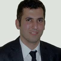
MOHAMMAD ZARE
Snr Scientist, Luxembourg
Title: USE OF MACHINE LEARNING TECHNIQUES FOR PROCESSING REMOTELY SENSED IMAGES OF FLOODS
Biography:
Dr. Mohammad Zare is working as a senior scientist, with focus on flood simulation/prediction models applying machine learning (ML) and artificial intelligence (AI) techniques, spatial data management and developing remote sensing models at RSS-Hydro’s research and education department (RED), Luxembourg. He graduated from his PhD in July 2017 at the University of Kassel, faculty of Civil and Environmental Engineering, Germany. Dr. Zare has been working at several universities and research institutes in Germany and Luxembourg. During years past, his research ideas were funded through projects by different funding frameworks, including the German Academic Exchange Service (DAAD), EU-funded ICT-AGRI and the Luxembourg National Research Fund (FNR).
Abstract
Changing hydrological conditions are occurring all over the world, owing mostly to phenomena of climate change that affect atmospheric and earth surface processes. Temporal and spatial changes in rainfall have caused fundamental variations in the water cycle, including extremes such as flood events. Losses due to all types of floods are not only of economic nature (several billions of EUR every year at global level) but there is also considerable loss of lives. Responding appropriately to these threatening situations necessitates the use of innovative flood management techniques and technologies more than ever. The main priority of any flood management solution is to find suitable methods and models in order to manage floods better and to prepare facing this natural hazard and risk phenomenon and minimizing losses. Decision making and planning for the prediction of flood events and their generating processes require the use of adequate models and methods. In recent years, appropriate models and algorithms such as machine learning (ML) and deep learning (DL) have been developed and used in many research projects dealing with flood mapping. In this regard, the main purpose of this study is to present a review of applying ML/DL methods to process remotely sensed images for generating flood maps. Moreover, the basic concepts of some ML data driven methods are presented. Three case studies with different ML algorithms have been selected and are illustrated to provide a better understanding of their application in flood studies. The findings of these case studies show that ML models are mostly applied to identify and predict flooded versus non-flooded pixels in images but important challenges remain. These challenges need to be solved if ML is to be valuable for decision making processes related to flood management.
- Artificial Neural Network and Virtual Intelligence
- Machine Learning and Decision Management
- Robotics and Intelligent System
- Big Data Analysis and Data Mining
- Cyber Defence and Cyber Security

