Venue & Hospitality


About City
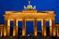
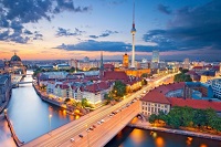
Germany’s division after the war put Berlin entirely within the territory of the German Democratic Republic (GDR, or East Germany). The city itself echoed the national partition—East Berlin being the capital of East Germany and West Berlin a Land (state) of the Federal Republic of Germany (FRG, or West Germany). West Berlin’s isolation was later reinforced by the concrete barrier erected in 1961 and known as the Berlin Wall. Its status as an enclave made Berlin a continuous focus of confrontation between the Eastern and Western powers as well as a symbol of Western lifestyle for 45 years. The fall of the East German communist regime—and the accompanying opening of the wall—in late 1989 unexpectedly raised the prospect for Berlin’s reinstatement as the all-German capital. That status was restored in 1990 under the terms of the unification treaty, and subsequently Berlin was designated a state, one of the 16 constituting Germany. These developments heralded the city’s return to its historic position of prominence in European culture and commerce. Area 344 square miles (891 square km). Pop. (2005 est.) 3,395,189.
The city site
Berlin is situated about 112 miles (180 km) south of the Baltic Sea, 118 miles (190 km) north of the Czech-German border, 110 miles (177 km) east of the former inner-German border, and 55 miles (89 km) west of Poland. It lies in the wide glacial valley of the Spree River, which runs through the centre of the city. The mean elevation of Berlin is 115 feet (35 metres) above sea level. The highest point near the centre of Berlin is the peak of the Kreuzberg, a hill that rises 218 feet (66 metres) above sea level.
Climate
Berlin lies where the influence of the Atlantic Ocean fades and the climate of the continental plain begins. The city’s mean annual temperature is about 48 °F (9 °C), and mean temperatures range from 30 °F (−1 °C) in winter to 65 °F (18 °C) in summer. The average precipitation is 22 inches (568 mm). About one-fifth to one-fourth of the total falls as snow.
Venue
Best Western Premier Airporthotel Fontane Berlin, Germany
